Collection: Pocket Pals Trail Maps
Pocket Pals Trail Maps started in 2011 by to better address the needs of hikers in Colorado State.
We don't just offer maps, but guides that provide you with the detailed information that you have been searching for including:
- detailed directions to the trailhead (since many of Colorado's trailheads are not marked)
- the longitude/latitude for the parking area
- trail length
- allowed trail uses
- difficulty rating
- identification of all trail intersections
- elevation gains/losses
- elevation profiles.
In addition, one of the most unique features of our trail maps is that each trail description contains numerous waypoints or landmarks that have been identified while collecting GPS data on the trails. Each waypoint has a trail mileage associated with it. Our waypoints identify a variety of landmarks along each trail including: trail intersections, stream crossings, overlooks, significant geologic features, ridgelines, ruins, bridges, views, etc. These waypoints act as your guide so that you ALWAYS stay on track!
NOTE: waypoints are included in most, but not all, of our trail maps.

-
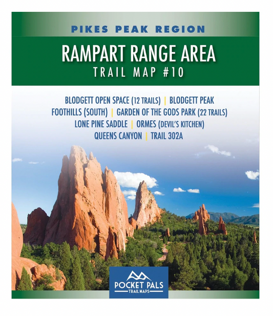
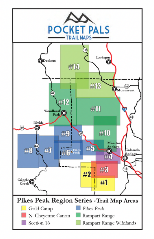
Pocket Pals Trail Maps-Rampart Range Area Trail Map #10
Regular price $7.95 USDRegular priceUnit price per -
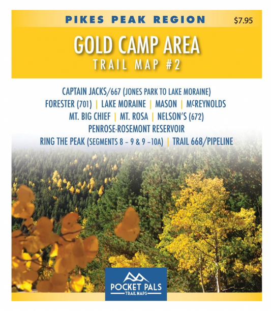
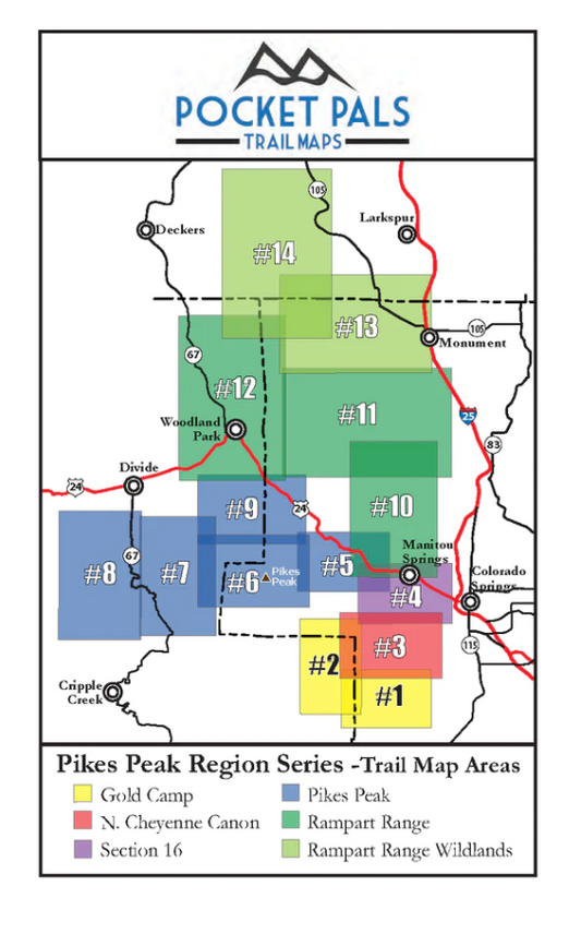
Pocket Pals Trail Maps- Gold Camp Area #2 Trail Map
Regular price $7.95 USDRegular priceUnit price per