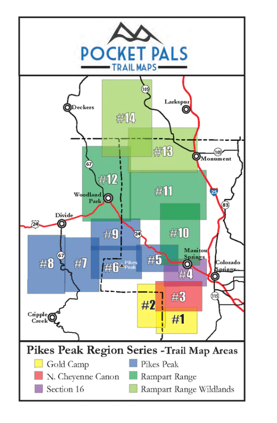
Pocket Pals Trail Maps
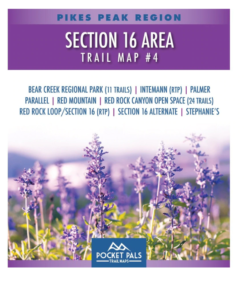
Pocket Pals Trail Maps- Section 16- Red Rock Canyon Area #4 Trail Map
Pocket Pals Trail Maps- Section 16- Red Rock Canyon Area #4 Trail Map
The trails on this map are located in the western portion of Colorado Springs, Colorado. Most of the trails are within the Bear Creek Regional Park, Red Rock Canyon Open Space, Section 16, Bear Creek Canyon Park, or in the southern portion of Manitou Springs.
The trails included on this trail map are listed below. For a detailed description, photos, videos, and reviews of these trails click on the highlighted trail names below.
-
Bear Creek Regional Park (11Trails)
-
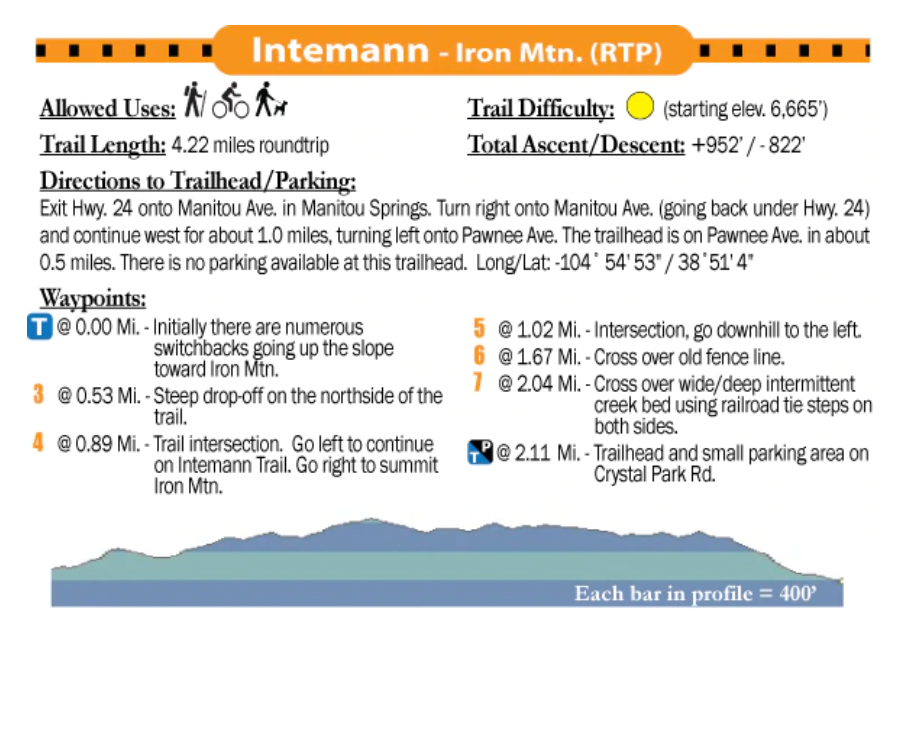
Intemann - Ring the Peak (RTP)
-
Palmer
-
Parallel
-
Red Mountain
-
Red Rock Canyon Open Space (24 Trails)
-
Red Rock Loop / Section 16 (RTP)
-
Section 16 Alternate
-
Stephanie's
* RTP = Ring the Peak Trail
A portion of every sale supports local trails, park, open space and conservation/restoration non-profits.
Couldn't load pickup availability
Share