1
/
of
3
Pocket Pals Trail Maps
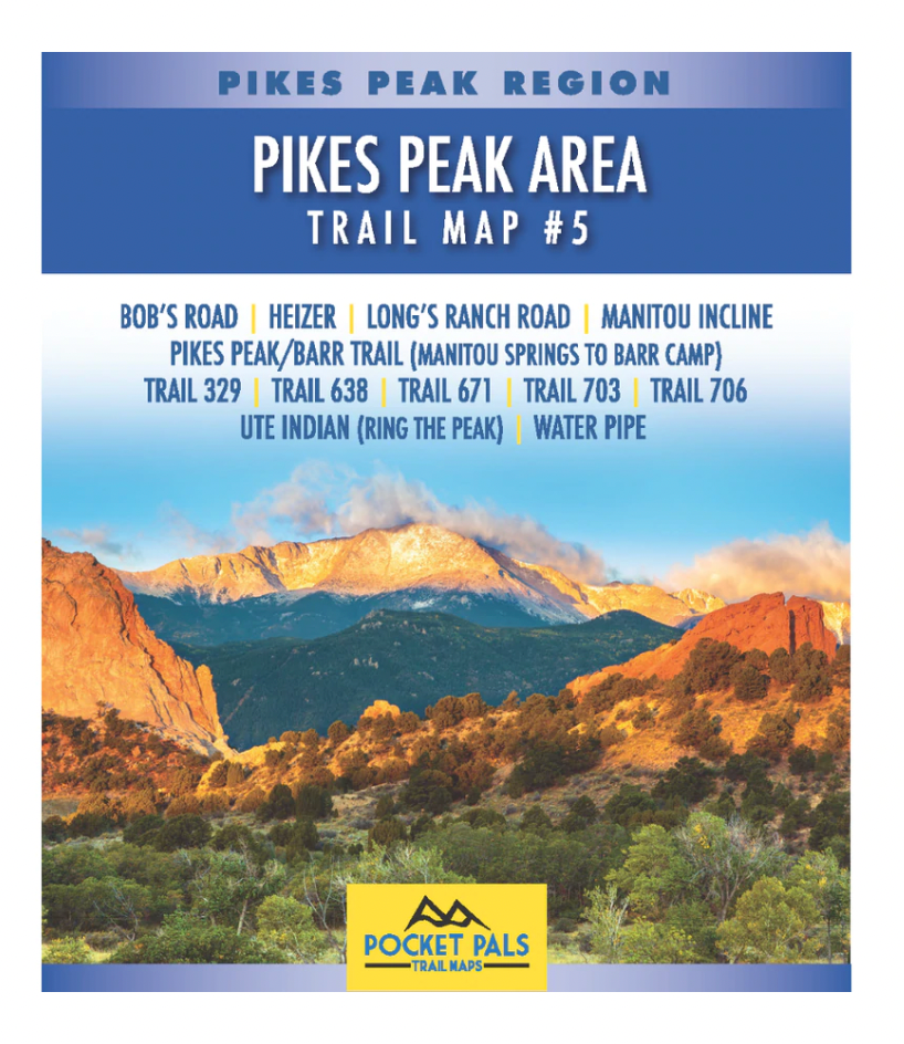
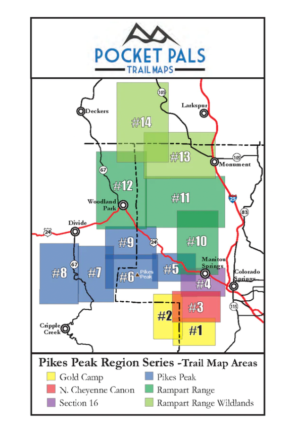
Pocket Pals Trail Maps- Pikes Peak Area Trail Map #5
Pocket Pals Trail Maps- Pikes Peak Area Trail Map #5
The trails on this map are located just west of Manitou Springs and include the first half of Barr Trail. Most of the trails on this map are in the Pike National Forest.
Click on the highlighted trail names below for more detailed information on each trail.
- Bob's Road
- Heizer
- Longs Ranch Road
- Manitou Incline
- Pikes Peak - (via Barr Trail) Manitou Springs to Barr Camp
- Trail 329
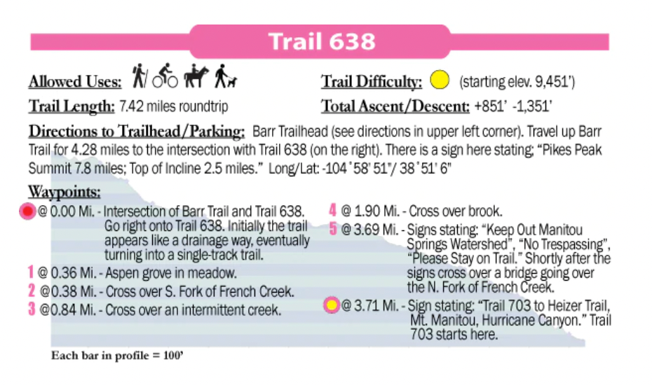
- Trail 638
- Trail 671
- Trail 703
- Trail 706
- Ute Pass (Ring the Peak)
- Water Pipe
If your intent is to explore the lower half of Barr trail, the Manitou Incline or the many trails along the lower, eastern flank of Pikes Peak, Trail Map #5 is your best map option.
If your primary intent is to summit Pikes Peak, the Pikes Peak 14er map may be your best map option.
A portion of every sale supports local trails, park, open space and conservation/restoration non-profits.
Regular price
$7.95 USD
Regular price
Sale price
$7.95 USD
Unit price
/
per
Couldn't load pickup availability
Share